대자연의경치 [스크랩] 길의 끝자락들 (The Ends of the Road) // 사진들 (Photos)
청산노을
2013. 7. 7. 23:19
The Ends of the Road
Jun 14, 2013 |
Inspired in part by the great geography game GeoGuessr , I spent some time recently in Google Maps, finding the edges of their Street View image coverage. I've always been drawn to the end of the road, to the edges of where one might be allowed to travel, whether blocked by geographic features, international borders, or simply the lack of any further road. Gathered below is a virtual visit to a few of these road ends around the world -- borders, shorelines, dead ends and overlooks from New Zealand to Svalbard, from Alaska to South Africa. [ 26 photos ]
Use j/k keys or ←/→ to navigate Choose: 1024px 1280px
At the end of the Milford Sound Highway, in Southland, New Zealand, part of Fiordland National Park. See it Mapped . (© Google, Inc.)
Kaimu-Chain of Craters Road, Hawaii. Past eruptions of the Kilauea volcano have covered the road in several places. Mapped . (© Google, Inc.) #
The Southernmost point buoy in Key West, Florida. Mapped . (© Google, Inc.) #
A village at the end of the road, near Sund, Norway - Mapped . (© Google, Inc.) #
Sha Tau Kok crossing, New Territories, Hong Kong. This crossing marks the entry into the Frontier Closed Area, a tightly controlled buffer zone between Hong Kong and mainland China. Mapped . (© Google, Inc.) #
A weathered jetty on Sand Island, Midway Islands. Mapped . (© Google, Inc.) #
Melago, at the end of a valley road in South Tirol, Italy. Mapped . (© Google, Inc.) #
The southernmost point in Africa, Cape Agulhas, South Africa. Mapped . (© Google, Inc.) #
Massive sculptures of U.S. presidents, in the lot of SculpturWorx, at the end of Summer Street in Houston, Texas. Mapped . (© Google, Inc.) #
The rocks of El Arco de Cabo San Lucas, viewed between buildings in Cabo San Lucas, at the southern tip of Baja California, Mexico. Mapped . (© Google, Inc.) #
Lighthouse Road, Byron Bay, New South Wales, on Australia's easternmost shoreline. Mapped . (© Google, Inc.) #
Ocean Park, in Hong Kong's Southern District. Mapped . (© Google, Inc.) #
As far north as the van was allowed to drive in Alaska. A BP checkpoint, on Spine Road, Prudhoe Bay, Alaska. Construction facilities are visible in the distance at upper right. Mapped . (© Google, Inc.) #
The Buckner Building, a massive WWII-era abandoned structure in the tiny port town of Whittier, Alaska. Mapped . (© Google, Inc.) #
Lagoa Azul, part of a twin-lake complex situated in the crater of a massive volcano on the island of Sao Miguel, Azores. Mapped . (© Google, Inc.) #
Canada to the left, United States to the right, on Henderson Road, British Columbia. The road turns left just ahead, the line cut through the trees at center marks the international border. Mapped . (© Google, Inc.) #
A CBC News camera operator at work on the U.S.-Canada border. Gladwyn Road, in British Columbia, dead-ends at the border, the trees in the background are on U.S. soil. Mapped . (© Google, Inc.) #
Kun Iam Temple, Coloane, on a hilltop in Macau. Mapped . (© Google, Inc.) #
A bust of Vladimir Lenin in Pyramiden, a former Soviet-run coal mining facility, now abandoned in Svalbard. Mapped . (© Google, Inc.) #
One of the easternmost points along Brazil's Atlantic shoreline (at least as far as Google's Street View team have covered), Avenida Beira Mar, in the town of Paulista. Mapped . (© Google, Inc.) #
The northermost point in Thailand, along the Mae Sai River. Burma lies across the river. Mapped . (© Google, Inc.) #
A view of the Chilkat Range, across Lynn Canal from the borough of Juneau, Alaska, about as far north of the city as one can drive. The capital city has a small road system, but is not connected to any outside roads -- the only way in or out is by air or by sea. Mapped . (© Google, Inc.) #
Ubehebe Crater, a volcanic crater in Death Valley National Park, California. Mapped . (© Google, Inc.) #
Southland, New Zealand, about as far south as one can go on South Island. Mapped . (© Google, Inc.) #
Nordkaphallen, a visitor center at the northernmost tip of Europe, in northern Norway. Mapped . (© Google, Inc.) #
A Google Maps Street View car, photographed at the end of Navy Road, north of Inuvik, Northwest Territories
사진들 (PHOTOS)
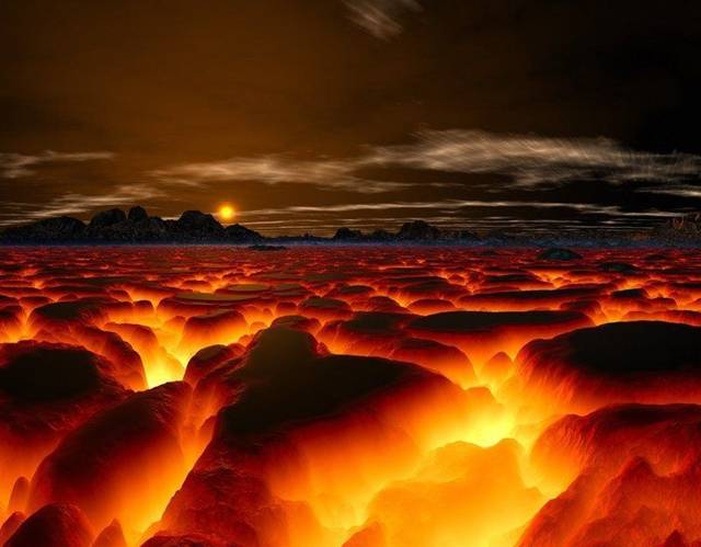
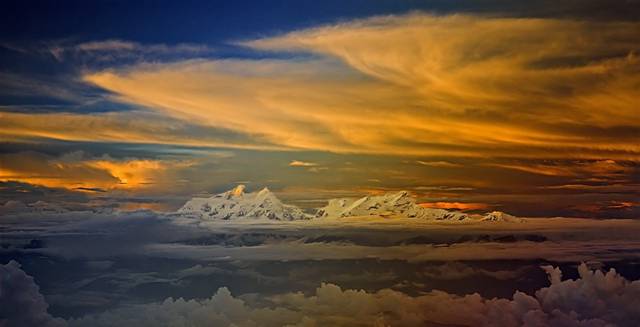
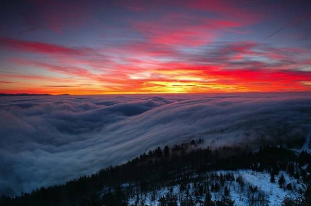
Low clouds over a volcano .
The world awakens.
세상이 깨어나고 있다 .
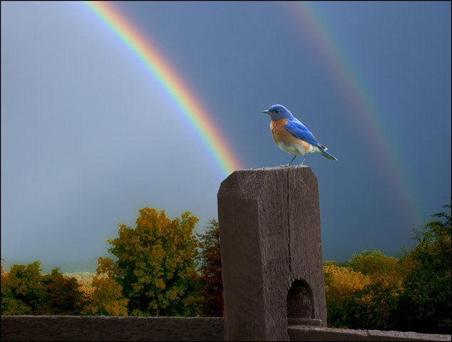
[Notice that the bird's color and the rainbow match?]
새의 색깔 무지개의 색깔이
서로 어울리고 있는 것을 보시죠 ?
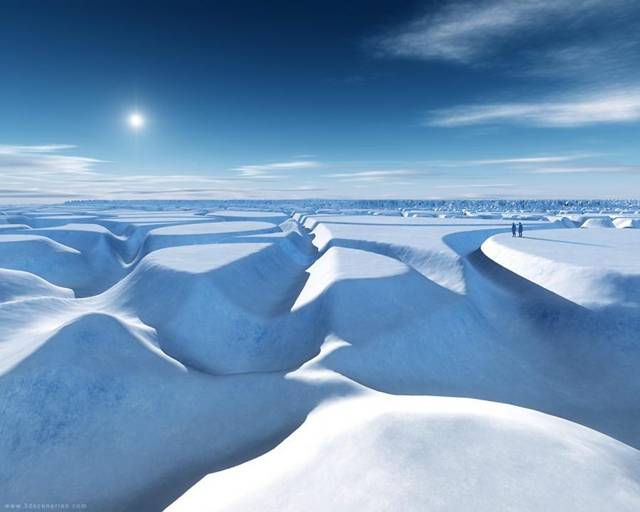
Interesting patterns.
What does it feel like to be totally alone?
흥미로운 도안 ( 패턴 ) 들이네요 .
아주 혼자 남겨지는 기분이 어떨까 ?
So peaceful! The World going to sleep!
It's so nice to have friends!
Luminescence is beautiful. Color is an amazing gift!
"On a clear day," wonder what you would see?
Life Is SO Good!
아주 좋은 삶 !!!!!
God's creations are truly awesome!
And, again.... Any questions??
그리고 다시 한번 묻는 데 ... 아무 질문없소 ?
OMG! Should you ever, really have any questions
about our 'God given' world....
이거 보게나 ! 하나님이 주신 우리의 이 놀라운 세상에
관해 정말로 어떤 질문 가진 적 없었단 말인가 ?
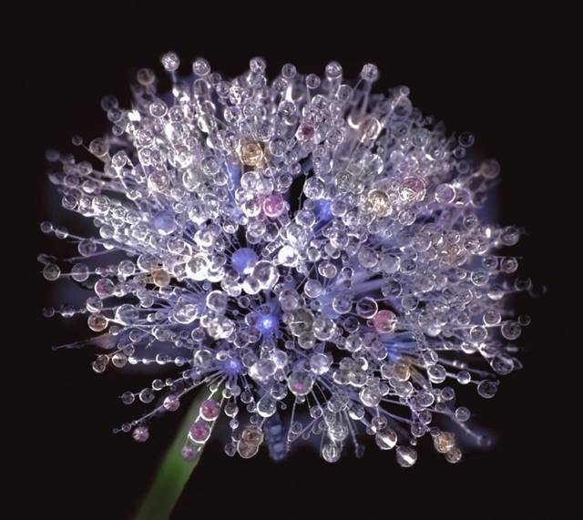
WOW!!! A dandelion covered with dew. Love it!!
와 !!! 이슬로 덮인 민들레 꽃 . 정말 좋아요.
Now, That's a shower. What a bathtub, too!
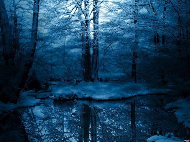
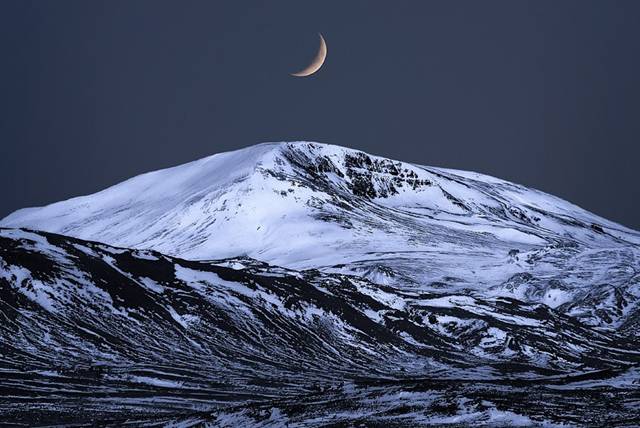
Winter shows off her silver lining! Beautiful!
겨울이 저의 자랑 거리를 보여주고 있네 ! 예쁘다 !
Slippery, when wet!
Never go swimming alone.!
(He seems to be in camouflage! )
홀로 수영 가지 마세요 !
Life, at a little different angle . . .
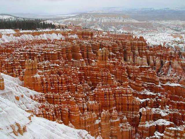
Winter in the Smokies. They really do look a lot like this!!!
스모키스라는 미국 동부 산맥의 겨울 풍경 .
실로 풍경들이 이 사진과 아주 비슷하지요 !!!
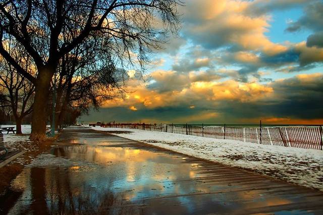
Hope you remembered to fill the tank!
가솔린탱크에 기름 가득 채우는 것 잊지 않았기를 바래요 !
A great opportunity for exercising your imagination,
in the clouds, as well as road side!! Love it!!
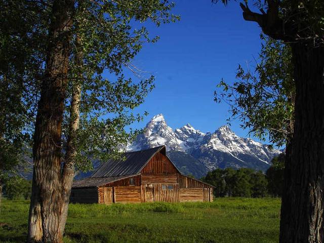
How breathtaking!!
How Majestic! 얼마나 장엄한가 !
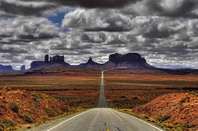
Don't you wonder what pioneers must have thought??
개척자들이 무얼 생각 했을까
궁금 해 지네요 ?
Cat nap anyone? Beats a Beauty Rest, any day.
Ahhhhh...now this is what I call 'Heaven'!!!
아 ... 이제 이것이야 말로 내가 " 천국 " 라는 곳이야.
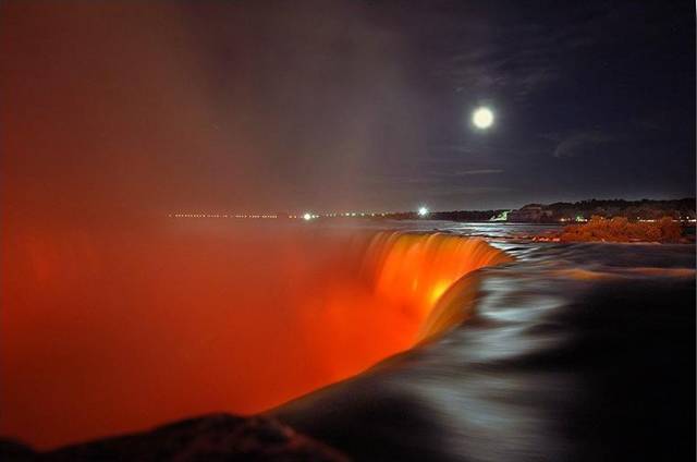
Niagara Falls
Ring around the Rosie . . .
로씨 를 부르며 둘러 싸자 ....
(아이들이 손잡고 동그란 원을 그리면서
놀 때 부르는 노래 )
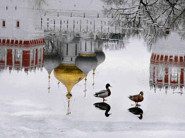
Do you have these in something smaller?
I want to live here.
출처 : 소담 엔카
메모 :